Hiking the Esterel: dazzling contrast of red rocks and azure sea
🚀 Key Takeaways
- Core concept : The Esterel is a volcanic massif of red rhyolite and porphyry that frames a dramatic coastal landscape.
- Practical tip : Hike from March to June or September to October, bring 2 liters of water, sun protection and sturdy shoes.
- Did you know : The coastal path GR51 and the corniche d'Or offer spectacular viewpoints, including the iconic Île d'Or near Agay.
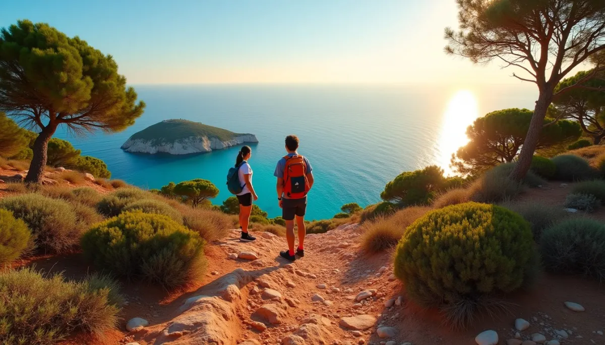
Light erupts on the rocks. Imagine a sunrise that makes the cliffs look like molten copper, and the sea respond in a hard, deep blue.
From the Agay bay to Cap Roux, the trail twists over ridges of red porphyry and small coves. Aleppo pines cling to crevices, their silhouettes cut against the horizon. A fisherman in a small boat, a young couple pausing on a viewpoint, the distant hum of the Corniche d'Or: these are the human notes in a landscape that seems painted. The scent of resin, the crunch of porphyry underfoot, the blink of lizards on warm stones, all create an immediate intimacy with the place.
Roches en feu
The Esterel owes its drama to volcanic rocks, mainly red rhyolite and porphyry, formed during intense volcanic activity roughly 250 to 300 million years ago. The iron oxides in these lavas give the massif its characteristic color, visible from the sea and from many viewpoints along the coast.
Geologists point out that this red massif is one of the few places on the French Mediterranean coast where such volcanic formations reach the shoreline. The contrast with the azure sea is not only aesthetic, it is geological: where rock meets water, erosion sculpts cliffs, stacks and small sheltered coves.
Today, visitors can follow sections of the GR51, the coastal trail that crosses the Esterel, or choose shorter circuits like the loop to Cap Roux or the path to the Île d'Or off Agay. These itineraries highlight rock features, creeks and panoramic terraces, and they are maintained by local communes and volunteers.
Sentiers et récits
Hiking in the Esterel has become a favorite activity for residents and visitors alike. Since the 1980s, more walkers and trail runners have discovered the massif, drawn by short access times from Nice, Cannes and Saint-Raphaël. A two-hour drive from Marseille, the Esterel is compact and intense, ideal for day trips.
Local stories and personalities enrich the walks. The Île d'Or, with its small square tower, is an emblem seen from the Agay shore. Sailors, painters and photographers have long been captivated by this micro-archipelago. In the 20th century, artists found light and color here that differed from the pale calanques further west.
Practical data: several mapped loops exist between 5 and 18 kilometers, with elevation gains usually under 500 meters. Mobile coverage is variable on exposed ridges. In summer, signposting and paths may be restricted because of fire risk; check local information at the town halls of Saint-Raphaël, Mandelieu or Fréjus before setting off.
Pourquoi partir maintenant
The appeal of the Esterel goes beyond its visual contrast. Its proximity to urban centers, combined with a sense of remoteness on the trails, makes it attractive for short escapes. Hikers can feel detached within thirty minutes of leaving a coastal car park.
Naturalists appreciate the biodiversity. Aleppo pines, mastic and kermes oak form a shrubland that shelters many birds and reptiles. The Hermann's tortoise can be found in some dry areas. Marine life in the coves is lively: snorkelers often report wrasses and small schools of fish near the rocky beds.
Conservation efforts and awareness campaigns by local associations have improved path maintenance and reduced trail erosion. Responsible hiking—staying on marked trails, carrying out waste and avoiding fires—helps preserve the fragile mosaic of rock and scrub.
Attention et contrastes
Despite its compact beauty, the Esterel presents contradictions. The area is increasingly popular, and peak season traffic on the Corniche d'Or and popular parking areas can spoil the sense of solitude that draws many walkers.
Fire risk remains serious in summer. The massif's vegetation becomes highly flammable when temperatures rise. Authorities impose restrictions and sometimes close trails. Respecting bans on barbecues and open flames is essential for everyone who loves the place.
Finally, the abrupt terrain demands respect. Some paths are exposed and rocky, and inexperienced hikers should choose marked, moderate routes. Guided walks with local guides are a good option to learn about geology, flora and local history while hiking safely.
Thanks for reading, and don't forget, Enjoy Life Moments!